Pipeline Integrity Along the Trans-Alaska Corridor
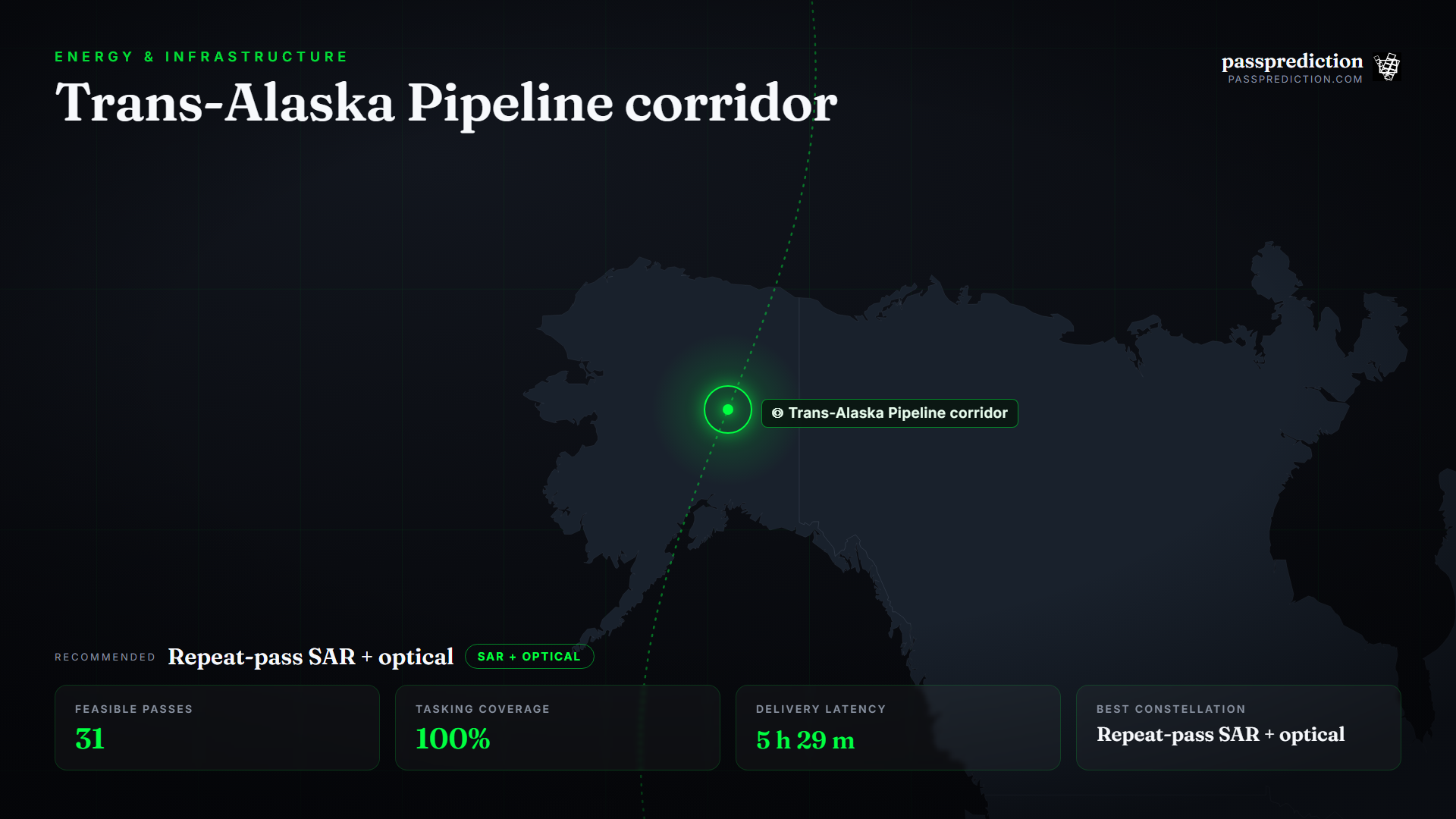
The Trans-Alaska Pipeline runs roughly 1,300 km across permafrost and seismically active terrain, where ground movement and third-party encroachment both threaten the line's integrity. Monitoring an asset that long and that remote is a planning problem: you have to cover a thin corridor for hundreds of kilometres, on a schedule, and detect movement measured in millimetres.
Detecting that shift is a repeat-pass SAR (InSAR) job, complemented by optical for right-of-way encroachment. PassPrediction lets you draw the corridor as your AOI, evaluate every pass whose swath crosses it, and plan the consistent SAR cadence InSAR needs plus periodic optical — then compare constellations so you order the coverage that fits the whole line, not just a segment.
Define the corridor AOI and the cadence
A pipeline is a thin polygon hundreds of kilometres long, so plan the AOI as the right-of-way corridor and evaluate every pass whose swath crosses it. Sort candidate passes by how much of the corridor each one captures, so you minimise the number of acquisitions needed for full-length coverage — a wide swath crosses more line per pass.
Run the corridor on a recurring cadence. For encroachment and vegetation growth, periodic optical builds a defensible record; for ground movement, InSAR demands a fixed, consistent-geometry SAR cadence. PassPrediction shows the upcoming passes so you can lock both schedules against the same corridor.
Why repeat-pass SAR + optical wins here
Permafrost thaw, frost heave, and seismic slip all show up as slow ground deformation, and SAR interferometry measures that millimetre-scale movement along the corridor between consistent repeat passes — flagging at-risk segments before failure. Radar also works through Alaska's long winter darkness and persistent cloud, keeping the deformation series unbroken when optical cannot see.
Optical earns its place for the human-scale threats: new access roads, dig-ins, and vegetation encroaching on the right-of-way read best in VHR optical, on a periodic schedule. The two together — how the ground is moving, and what is happening on the surface — form a complete corridor-monitoring programme, which PassPrediction lets you plan across every operator at once.
Turn feasibility into a plan
Run a pass search over the corridor and split the plan: SAR passes with consistent geometry for the InSAR stack, and periodic optical in daylight for encroachment. Sort by coverage so the passes that sweep the most corridor rise to the top, and use the tasking view to confirm how many passes cover the full length.
Add the latency estimate so integrity findings reach the operations centre promptly, and run the constellation comparison to rank the SAR and optical options together. The output is a ranked, neutral corridor plan you fulfil with the providers of your choice.
Recommended constellation
Repeat-pass SAR + optical — over the Trans-Alaska Pipeline corridor Area of Interest.
- SAR for InSAR (repeat-pass) — Millimetre-scale subsidence and ground-movement monitoring along the pipeline corridor.
- Wide-swath SAR / optical — Efficient coverage of a 1,300 km right-of-way with fewer passes per cycle.
- Optical VHR (≤0.5 m) — Encroachment, new access roads, and right-of-way vegetation on a periodic schedule.
The mission, run over Trans-Alaska Pipeline corridor
Feasible passes
31 feasible passes over the AOI in 3-day.
| Best pass | Start (UTC) | Coverage | Off-nadir |
|---|---|---|---|
| ICEYE-X36 | 2026-07-15T11:24:37.393680+00:00 | 100% | 0° |
Delivery latency
| Stage | Duration |
|---|---|
| Order ingest | 10 s |
| Uplink wait | 3 m |
| Execution | 4 h 23 m |
| Downlink wait | 51 m |
| Processing | 10 m |
| Delivery | 1 m |
| Total | 5 h 29 m |
Downlinked through KSAT TrollSat (Antarctica). A high-latitude corridor is naturally served by regional commercial polar ground stations, which see the sun-synchronous SAR and optical fleets on nearly every orbit for low-latency delivery.
Frequently asked questions
How do I monitor a long pipeline from space?
Plan the AOI as the right-of-way corridor and task wide-swath passes that cross it, sorting by how much corridor each covers to minimise the acquisitions needed for full coverage.
Can satellites detect pipeline ground movement?
Yes — SAR interferometry (InSAR) measures millimetre-scale subsidence and heave along the corridor between consistent repeat passes, flagging at-risk segments early.
Why SAR in Alaska specifically?
Long winter darkness and persistent cloud defeat optical for much of the year; SAR works regardless, keeping the deformation series unbroken.
Does PassPrediction sell the imagery?
No. PassPrediction does not sell imagery — it plans feasibility across all operators, then you order from the provider of your choice.
Plan a feasible acquisition
Draw your Area of Interest, set the window and look-angle limits, and PassPrediction ranks every feasible pass across all operators — neutrally, in your browser, free to start.
Open the planner →