Maritime Domain Awareness Over the Strait of Gibraltar
The Strait of Gibraltar is a 14 km-wide chokepoint linking the Atlantic and the Mediterranean, with hundreds of vessels transiting every day — a large share of Europe's oil and container traffic squeezed into a narrow lane. Coast guards and maritime-intelligence teams watch it for dark shipping and sanctions evasion, collision risk in dense traffic, and search-and-rescue. The catch is that much of the activity happens at night or under Atlantic cloud, exactly when optical sensors go blind.
PassPrediction plans that acquisition neutrally. Draw the strait as your Area of Interest, and the platform finds every satellite whose swath will actually sweep the lane in your window, ranks the passes by coverage and look angle, estimates when the imagery can be on the ground, and compares constellations so you know which one to order from — for continuous vessel detection through cloud and darkness, that means all-weather SAR.
Define the AOI and the observation window
Set the AOI to the whole chokepoint, not a single point — a vessel of interest moves several kilometres between overpasses, so you want every pass whose swath touches the lane. A narrow strait like Gibraltar rewards wide-swath SAR modes that blanket the transit corridor in one acquisition rather than a tight high-resolution chip that the target may have already left.
Choose a window that matches the operational tempo. For persistent monitoring, plan a recurring cadence across several satellites so a contact detected on one pass can be re-acquired on the next; for a specific event — a suspected AIS-off transfer — bracket the hours in question and let PassPrediction show you which passes fall inside them.
Why SAR wins here
SAR is the workhorse of maritime surveillance because a metal hull returns a strong radar signature against a dark sea, and radar sees through cloud and at night. Over Gibraltar, where weather and darkness routinely defeat optical sensors, an ICEYE or Capella pass still delivers vessel positions — including 'dark ships' that have switched off their transponders and would be invisible to an AIS-only picture.
Optical VHR still has a role: once SAR localises a contact, a follow-up optical pass at low off-nadir in daylight identifies hull type, length, and activity. PassPrediction lets you plan both — SAR to detect across the whole lane, optical to identify a specific position — and compare their feasibility side by side instead of committing to one sensor blind.
Turn feasibility into a plan
Run a pass search over the strait for your window and sort the results by coverage so the passes that truly sweep the lane rise above the ones that clip its edge. Filter by acceptable off-nadir angle, then use the tasking step to see how a swath is laid across the AOI and whether one pass covers it or several are needed.
Add the latency estimate to learn when each candidate image could actually reach you — the pass is only useful if the data is downlinked and delivered inside your decision window — and run the constellation comparison to rank operators on capability. The output is a ranked, neutral acquisition plan you take to the provider of your choice.
Recommended constellation
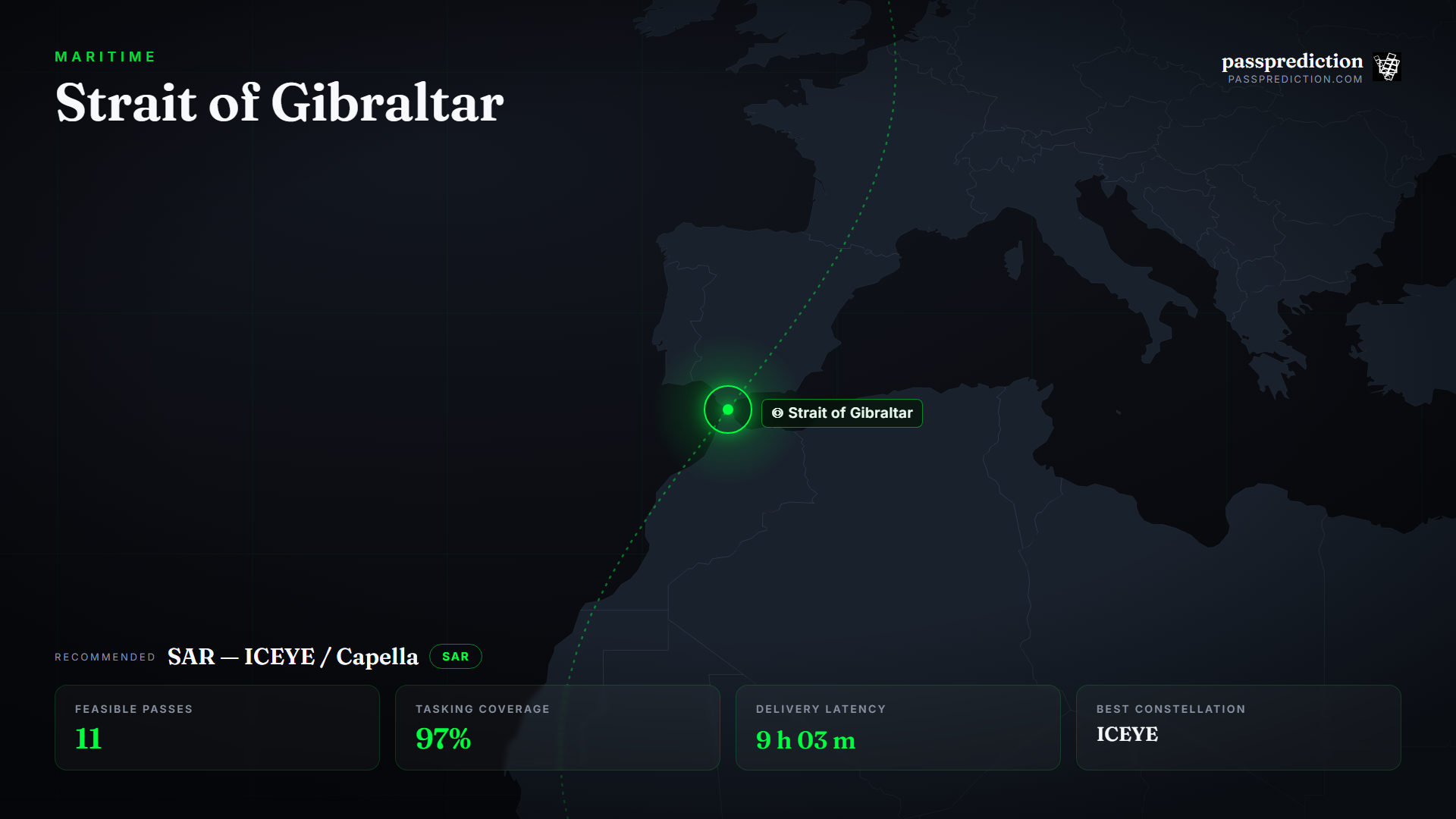
SAR — ICEYE / Capella — over the Strait of Gibraltar Area of Interest.
- Wide-swath SAR (ScanSAR) — Blanket the whole transit lane in one all-weather, day-or-night pass to catch AIS-off vessels.
- SAR Stripmap / Spotlight — Higher-resolution radar to confirm and geolocate an individual contact.
- Optical VHR (≤1 m) — Daylight identification of hull type, length, and activity once a contact is localised.
The mission, run over Strait of Gibraltar
Feasible passes
11 feasible passes over the AOI in 3-day.
| Best pass | Start (UTC) | Coverage | Off-nadir |
|---|---|---|---|
| ICEYE-X38 | 2026-07-13T15:49:52.692031+00:00 | 100% | 0° |
Delivery latency
| Stage | Duration |
|---|---|
| Order ingest | 10 s |
| Uplink wait | 25 m |
| Execution | 7 h 19 m |
| Downlink wait | 1 h 8 m |
| Processing | 10 m |
| Delivery | 1 m |
| Total | 9 h 03 m |
Downlinked through KSAT TrollSat (Antarctica). KSAT Svalbard captures the many polar-orbiting SAR downlinks at their most frequent contact latitude, while a Singapore-class equatorial station adds low-latitude dwell — together they shorten the time from acquisition to delivery.
Constellation comparison
| # | Constellation | Score |
|---|---|---|
| 1 | ICEYE | 1.00 |
| 2 | COSMO-SkyMed | 0.33 |
| 3 | Capella | 0.02 |
Frequently asked questions
Can satellites detect ships that turned off AIS?
Yes. SAR images the physical hull regardless of whether it broadcasts AIS, so 'dark ships' appear as radar contacts you can compare against the AIS picture to find the gaps.
Why SAR and not optical over Gibraltar?
The strait is often dark or under Atlantic cloud when the activity happens. SAR penetrates cloud and works at night, so it delivers vessel positions when optical sensors see nothing.
How wide a swath should I request?
For a search lane, wider usually wins: a ScanSAR-class swath covers the whole chokepoint in one pass, trading resolution for the coverage a moving target needs.
Does PassPrediction sell the imagery?
No. PassPrediction does not sell imagery — it plans feasibility across all operators, then you order from the provider of your choice.
Plan a feasible acquisition
Draw your Area of Interest, set the window and look-angle limits, and PassPrediction ranks every feasible pass across all operators — neutrally, in your browser, free to start.
Open the planner →