Tasking
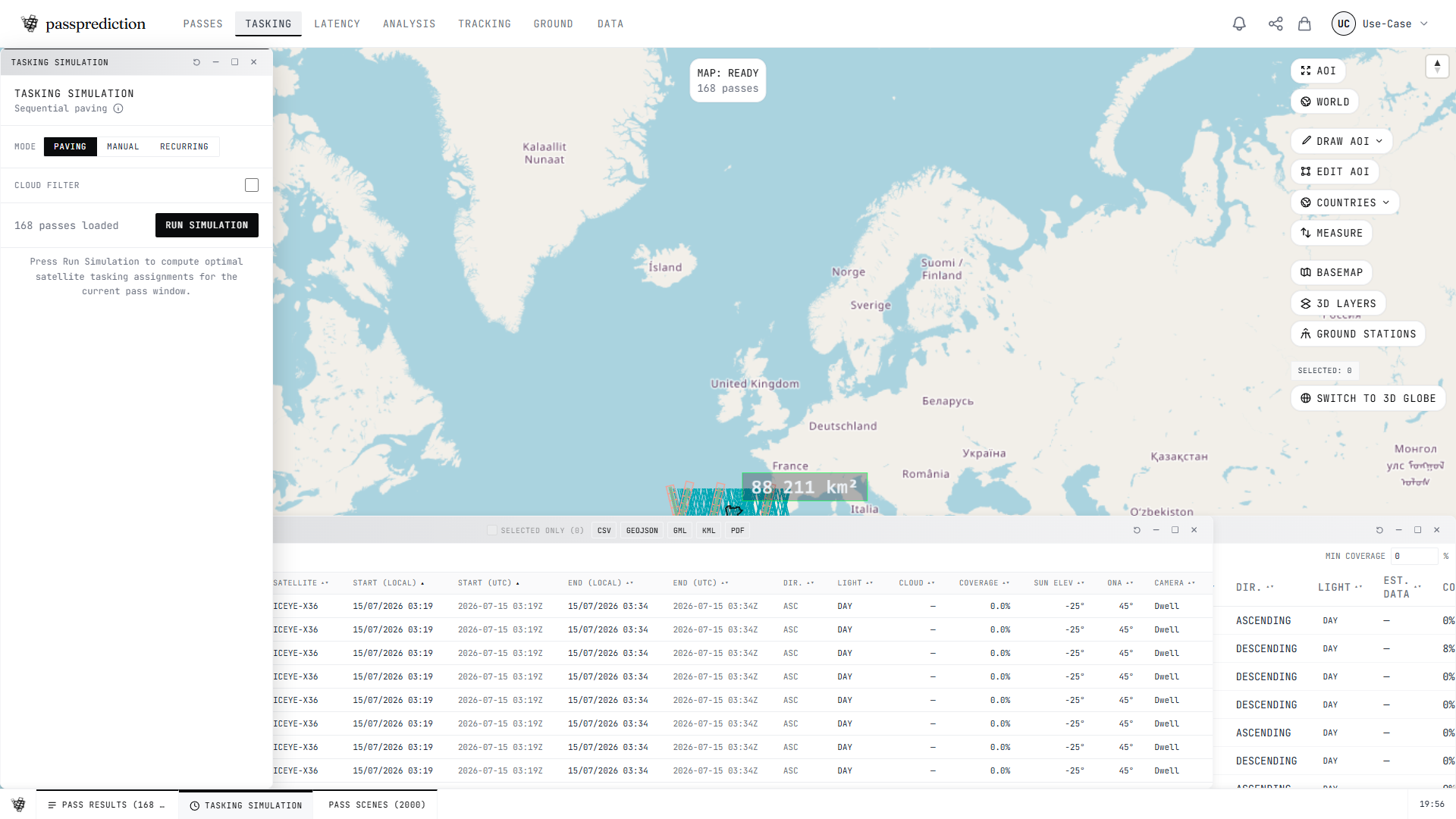
Simulate how a constellation is tasked to cover your AOI within off-nadir limits.
Step by step
- 1Set your AOI and select the satellites or constellation to task.
- 2Choose a tasking mode: paving, manual drag, or the global engine.
- 3Set the off-nadir (ONA) range and imaging mode constraints.
- 4Click RUN to assign passes/scenes into a coverage plan.
- 5Review the assignment table and coverage gaps, then export or animate the paving.
Frequently asked questions
How do I simulate tasking a constellation over my AOI?
Open the Tasking panel, confirm your AOI and selected satellites, choose a mode (paving, manual, or the global engine), and click RUN. The engine assigns passes/scenes to build coverage within your off-nadir (ONA) constraints and reports metrics like TIME TO COVER. Results appear in the tasking results drawer, with per-scene mode, camera, and orbit columns.
What are the different tasking modes and when should I use each?
Paving tiles the AOI with scenes automatically to reach full coverage; manual lets you click-and-drag pass footprints east/west while ONA updates live within your filter limits; the global engine solves coverage across recurring passes at scale with a frontier matcher and async optimize. Use paving for straightforward area coverage, manual to fine-tune a specific acquisition, and global for large or multi-pass campaigns. Each result row shows the mode, camera, and orbit used.
How do I manually shift a pass footprint to change its off-nadir angle?
In manual tasking mode, click and drag a pass footprint east or west on the map. The footprint shifts laterally across-track and a floating tooltip shows the live ONA, the delta from the base angle, and an at-limit warning when you reach your min/max ONA. This is a local, no-round-trip simulation — the tasking results table updates with base vs current ONA per pass.
Related help
Try it now on the interactive map, learn the underlying concepts in the glossary, or see all help topics.